Flight zones in Spain
Likewise, the maps are merely informative and in no case does it imply that AVLE guarantees or grants any type of authorisation for the practice of free flight in these areas, nor does it impose any limitation or prohibition, all of which is reserved to and regulated by the regulations in force.
The data have been obtained from IGN and INSIGNIA (CC BY 4.0 www.scne.es). The maps are property of AVLE and its author and are subject to the Law of Intellectual Property. All the uses that the LPI contemplates are prohibited except for their public communication in the terms that this law contemplates, and that the owner expressly authorizes.
Abantos, Central Zone
Mount Abantos (abanto is synonymous with alimoche) is located at the beginning of the Sierra del Guadarrama from the south. The orientation of the sierra at this point is southwest-northeast, with the flights being made towards the southeast. At its feet is the monumental town of San Lorenzo de El Escorial, and the flight, of about 700m, offers spectacular views of the sierra and the monastery. Behind it we have the pine forests of Peguerinos, already in the province of Avila.
Access is by vehicle with the permission of the Town Hall of S. Lorenzo until we pass the port of Malagón, and then walk almost three kilometres on a gently sloping track.
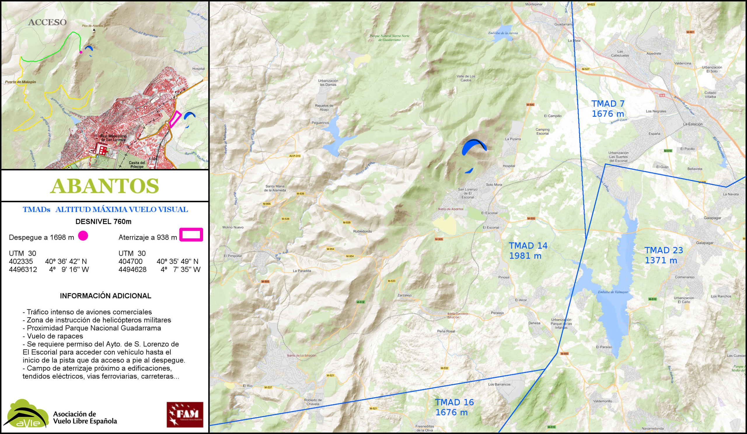
Map with data as of June 7, 2020
Mondalindo, Central Zone
The Mondalindo is a mountain located on the southern slopes of the Sierra de Guadarrama, in the northwest of the Community of Madrid. The mountain range has a southwest-northeast orientation and flights are normally made from south-southeast. On the southern slope are the towns of Miraflores de la Sierra and Bustarviejo. On the northern side we find Canencia and Garganta de los Montes.
El Mondalindo is about 1,833 metres high and has spectacular views. This area is full of Scots pine and oak forests. Access to the mountains is by walking from Bustarviejo. With a demanding ascent of at least forty or fifty minutes.
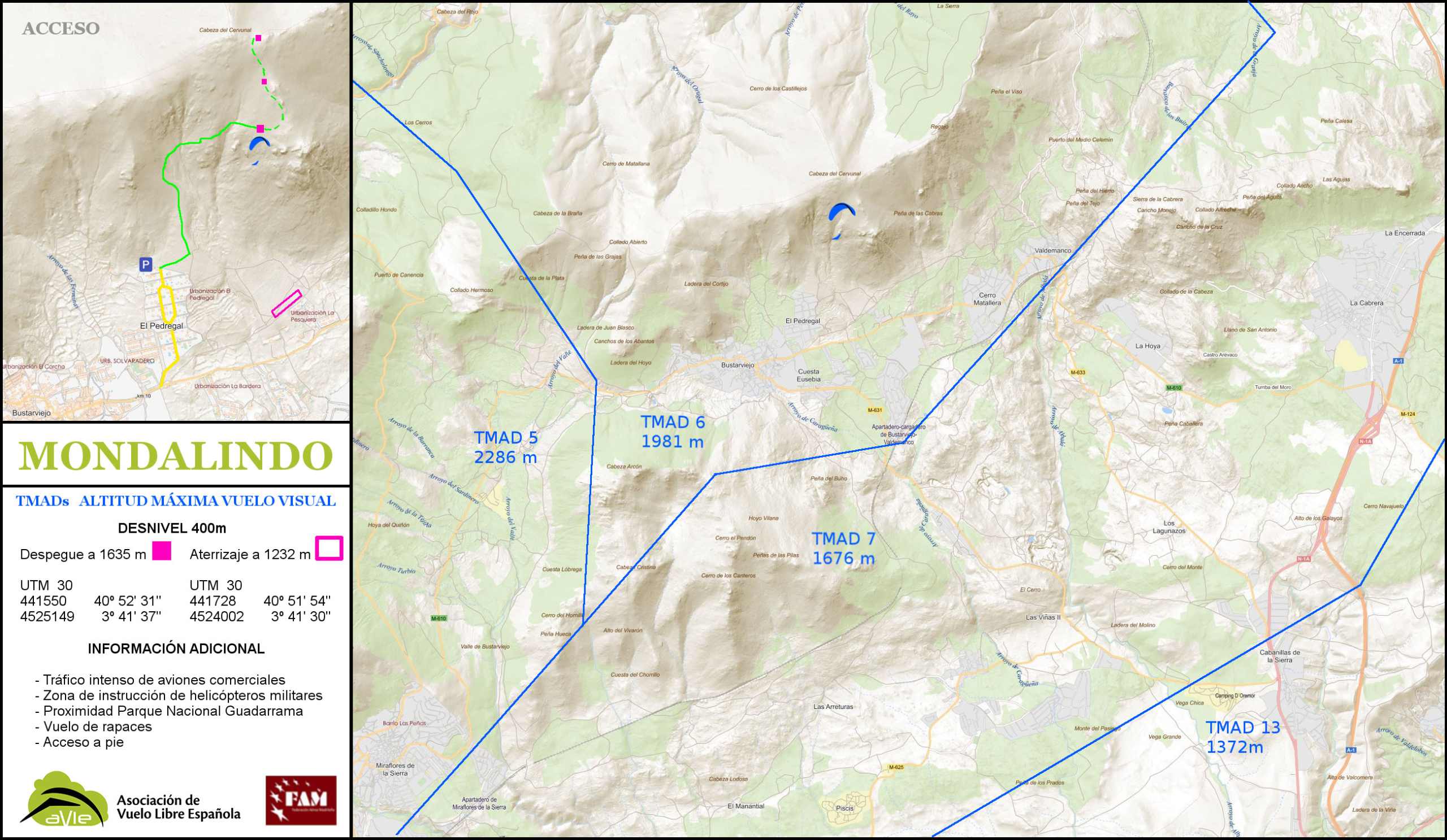
Map with data as of May 25, 2020
Arcones, Central Zone
Arcones is located in the province of Segovia, to the south bordering the province of Madrid. It is halfway between the ports of Somosierra and Navafría, on the national road 110. It is 120 kilometres from the capital of Madrid, most of the way along the A-1 motorway, Autovía del Norte. From Segovia city it is about forty kilometers by N-110.
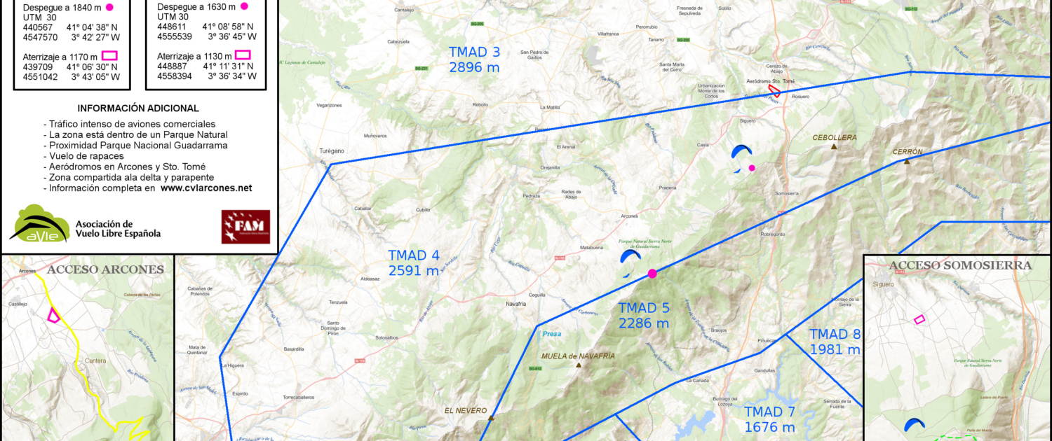
Map with data as of May 25, 2020
La Muela, Central Zone
La Muela in Guadalajara is one of those perfect places to practice free flight. The name of the mountain gives us clues about its peculiar shape. It is flat on its summit and has a great unevenness on the four slopes. In such a way that it creates a perfect space for flying. It offers us an excellent panoramic view over the Ocejón (2.046m) in the Sierra de Ayllón and the Alto Rey (1.858m).
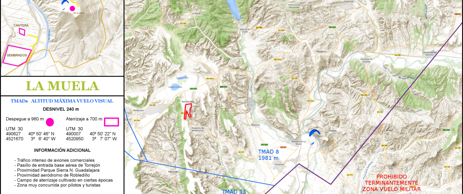
Map with data as of May 25, 2020
